
Today, I would like to share with you my self drive trip to the Shirakami Sanchi (白神山地), one of the four UNESCO World Natural Heritage Sites in Japan. If you are wondering which are the four sites, here’s the list:
- Shiretoko National Park in Hokkaido (which I had covered in an earlier article)
- Shirakami Sanchi in Akita/Aomori
- Ogasawara in Ogasawara island
- Yakushima in Yakushima island
Shirakami Sanchi sits across the border of Aomori and Akita, an extensive mountain range known for its natural Japanese beech (or buna) forests with a size close to 17,000 ha. It was added as an UNESCO World Natural Heritage Site in 1993.
When you are visiting Shirakami Sanchi, you are probably visitng the surrounding area as the core conservation area is quite inaccessible and requires a permit for entry. However, even the surrounding area holds many nature wonders for the visitor.
The best times to visit are late spring/early summer season where the waterways would be full from the melting snow and rain and autumn season to catch the changing foliage. Do note that many of the access roads are closed from November through May.
As the site is rather vast, you will need to do some planning for your trip. Which places to visit together, how much time would be need at each of the places of interest and travel time between places. Here are some of the places to visit, most of which would a rental car to move around.
1. Shirakami Sanchi Visitor Centre
The Shirakami Sanchi Visitor Centre (白神山地ビジターセンター, 0172-85-2810) is located in Aomori prefecture, on the east side of the national park along route 28, easily accessible if you are coming from Hirosaki, roughly 30 to 45 minutes by car.
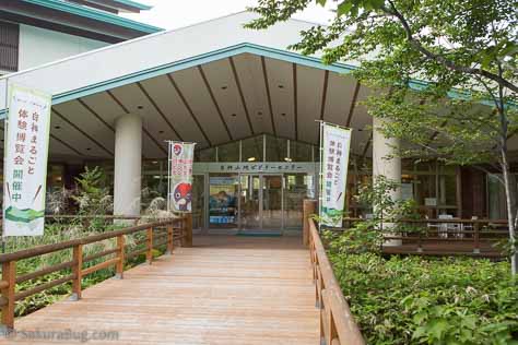
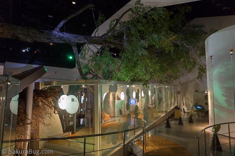
There are 3D models of the fauna and ecosystem inside, with extensive coverage of the beech eco system. In addition, an IMAX screen shows a 30 minute film about the area a few times daily. The opening hours of the visitor centre are seasonal, with it being closed on some days, usually Monday, so do check before making a trip down.
2. Aqua Green Village Anmon and Anmon Falls
The Aqua Green Village Anmon < http://www.kumagera.net> (アクアグリーンビレッジANMON, Tel: 0172-85-3021) is also located on the eastern side of the National Park. Here, you can find lodging, an onsen, a campground, specialty store and a huge play area. A place which you could use as a base for touring the eastern side of the Shirakami Sanchi World Natural Heritage Site.

From the Village, there are various walking trails available. One of which is the Beech forest walking trail, a 2km route (round trip) taking about 60 to 120 minutes.
The hiking trail to the Anmon Falls is also accessible from the village. The Anmon Falls are a set of three waterfalls. It will take around 45 to 60 minutes to reach the first fall and another 30 to 45 minutes to reach the other two.
3. Mount Futatsumori
On the western side of the park, which is more easily accessible from Akita, you have Mount Futatsumori from which you can get a great view of the mountains and valleys at the peak standing at an elevation of 1,086 m. The climb starting from the Futatsumori Mountain Trail Entrance, near to the car park, to the peak takes roughly 1 hour.
4. Juniko
Also on the western side of the park, further north along Route 101 but tranversing into Aomori prefecture, you will find Juniko (十二湖). Juniko literally means twelve lakes.
The GPS brought me to somewhere in Juniko, although I had keyed in the phone number for the Juniko Visitor Centre, leaving me to figure out my way around. Luckily, I managed to get hold of an area map.
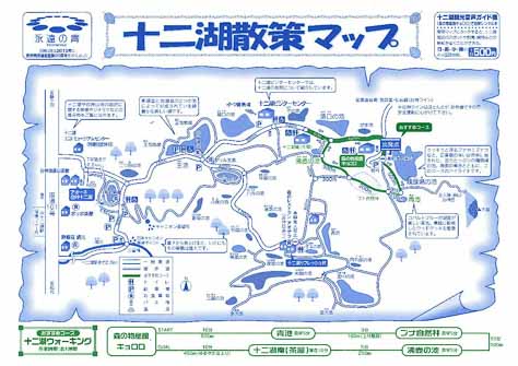
There are 2 entrances along Route 101 near the Juniko station into Juniko. If you are travelling north to Shirakami Sanchi from Akita, like what I did, I would suggest that you enter via the second entrance. The first entrace is just before the Juniko station, the second entrance is a little after the Juniko station. The second entrance will lead you into AWONE Shirakami Juniko <http://shirakami-jyuniko.jp/> (アオーネ白神十二湖, Tel: 0173-77-3311). You should see this signboard at the second entrance.
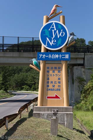

There is lodging available here if you want to make this a base for your western foray into Shirakami Sanchi. There are souvenir shops, restaurants and an outdoor play area here too. I had my lunch here and made my plans using the area map while having lunch. The 12 lakes are quite scattered and involves driving through narrow roads to reach each of them.
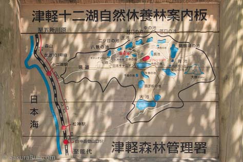
There is a recommended walking trail right at the end which takes you across 4 of the lakes as well as a beech forest – see the green marked trail in the area map. The estimated time needed is one hour. There is paid parking available at the start of the trail. Though I must say this is based on an honour system. Most people park their cars then make their way to the manual payment booth at the entrance of the car park.
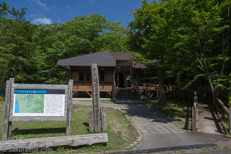
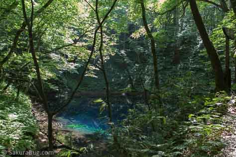
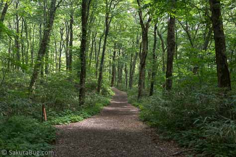
I located the Juniko Visitor Centre, which is an unmanned hut, had a quick look around before heading to the recommended walking trail. It is quite an easy walk, but do keep a watch out for vehicles on the small section towards the end, heading back to the start point, as you will be walking on the narrow road. Here’s a picture of the Aoike Pond along the trail and also the beech forest.
Yes, there is a souvenir shop with refreshments for sale at the entrance of the car park, your start and end point for the hike.
5. Route 28
No, do not try to cut through Route 28. After completing your explorations on the western end of Shirakami Sanchi, it is tempting to use Route 28 to reach the eastern end as it looks like a short cut. Here’s a local map snapped from an info board, do note that north is down, so Akita is on the right and Hirosaki is on the left.

At the Shirakami Sanchi stretch, Route 28 has around 41km of unpaved winding road that you will need to drive through. Most of the stretches are wide enough for just one vehicle to pass through, and mind you, it’s a 2 way road. You would be driving mostly at speeds of around 20 to 30 km/h, taking close to 3 hours of slow and painful driving to get through. Throughout the entire journey, less than 10 vehicles had passed me from the other direction.

I also like this map from Japan Guide showing the unpaved road sections. Unless you are planning to use the lookout points along Route 28, I would suggest that you use take Route 101 further north before looping down into Hirosaki and the eastern end of Shirakami Sanchi.
Ja
KL